Natchez Trace High Resolution Map
The Natchez Trace Parkway is a historic and scenic route that stretches approximately 444 miles from Natchez, Mississippi, to Nashville, Tennessee. Following the path of an ancient trail used by Native Americans and early European settlers, the parkway offers visitors a journey through centuries of American history and stunning natural landscapes. Along the route, travelers can explore a wealth of attractions, including historic sites, picturesque overlooks, and recreational opportunities.
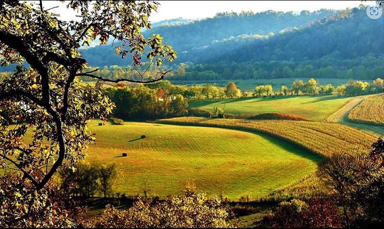
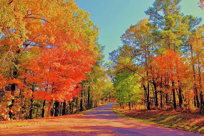
One of the defining features of the Natchez Trace Parkway is its serene and unspoiled natural beauty. The parkway winds through dense forests, rolling hills, and tranquil valleys, providing travelers with breathtaking vistas and opportunities for outdoor recreation. Hiking trails, picnic areas, and scenic overlooks dot the route, inviting visitors to immerse themselves in the splendor of the surrounding wilderness. Wildlife enthusiasts will delight in the chance to spot native animals such as deer, birds, and even the occasional black bear. Whether driving, cycling, or simply taking a leisurely stroll, exploring the Natchez Trace Parkway offers a rejuvenating escape into the heart of the American South, where history and nature converge in a harmonious tapestry.
The REVER Routed Ride can be found below.
TENNESSEE

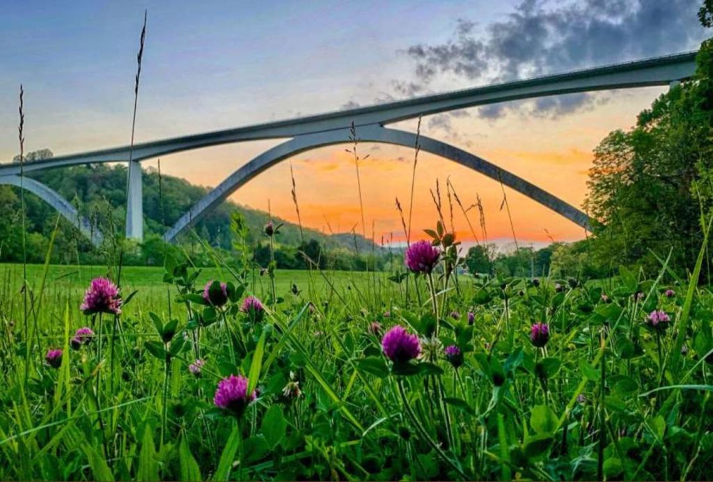
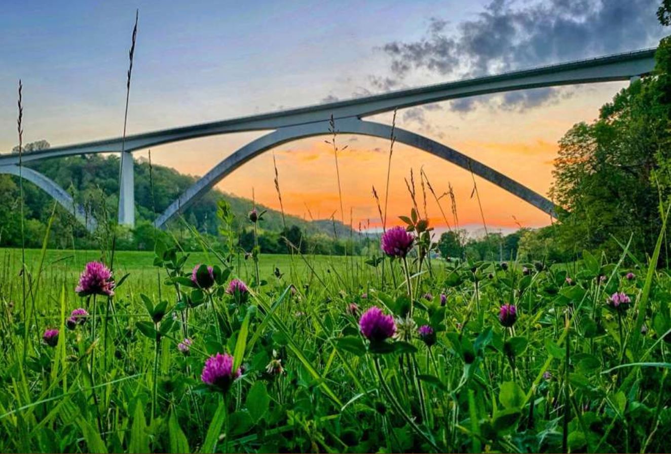
Birdsong Hollow and Double Arch Bridge, Milepost 438
The bridge can be viewed from two locations. We recommend taking in both views. Just north of the bridge there is a parking area with a view of the bridge and the valley below. Just south of the bridge is an exit ramp that takes you down to Tennessee Highway 96. At the bottom of the hill there is a parking area with a view looking up at the entire length of the bridge.
On June 6, 2022, the National Park Service (NPS) installed a temporary safety barrier on Double Arch Bridge. Construction crews installed a chain-link fence, topped with barbed wire, to provide a temporary safety barrier to deter further loss of life through suicide.
The NPS is working with the Federal Highway Administration on plans to install a permanent safety barrier to deter suicide. The temporary barrier will remain in place until a permanent barrier design is selected and constructed.
Gordon House Historic Site, Milepost 407.7
The brick home of Captain John Gordon and his family, built in 1818, was one of the impressive homes in the area. It was a landmark for travelers of the Old Trace, letting them know that soon they would be in Nashville, TN, where simple human comforts could be found after weeks of walking on a well-traveled but rustic trail. The Gordon family called it home, but it was a business as well. A ferry provided a safe way for travelers and locals alike to cross the Duck River.
Baker Bluff Overlook, Milepost 405
Baker Bluff Overlook offers one of the best scenic views along the entire Natchez Trace Parkway. In the valley below you will see farmland with cattle and barns. Photographers often setup tripods to get the best shots. Note: the view is to the east so afternoon and early evening is the best viewing time as the sun will be at your back.
A 3/4 of a mile trail connects Baker Bluff Overlook to the Jackson Falls site. The trail is fairly strenuous as it goes up and back down.

Jackson Falls, Milepost 404.7
This is one of two waterfalls on the Natchez Trace Parkway. To see this waterfall continue roughly 900 feet down the paved path to the waterfall. The water from this waterfall feeds into the Duck River which will lead to the Tennessee River.

Tobacco Barn & Old Trace Drive, Milepost 401.4
This barn was built for Mr. Leland Greenfield in 1959 from timber grown on this farm. Mr. Greenfield first grew tobacco here in 1932. The Greenfield family had owned the lad for 100 years before the State of Tennessee purchased and deeded it to the Natchez Trace Parkway in 1977.

Fall Hollow Waterfall, Milepost 391.9
Fall Hollow is one of two waterfalls along the Natchez Trace Parkway. Almost immediately after leaving your vehicle you can hear the water descending over the twenty foot drop making Fall Hollow waterfall. If you continue down this short trail you will come to a viewing platform that views the 20-foot tall waterfall. The trail and platforms get slippery due to the water and moisture of the area. Please watch your step.

Meriwether Lewis Burial Monument, Milepost 385.9
The Meriwether Lewis monument marks the burial site of famed explorer Meriwether Lewis on the Natchez Trace Parkway near present day Hohenwald, Tennessee. The Meriwether Lewis Monument was built in 1848 with funding provided by the Tennessee legislature. The legislation provided $500 “to preserve the place of internment, where the remains of General Meriwether Lewis were deposited.”

Metal Ford & Buffalo River on Old Trace Drive, Milepost 382.8
“I was roused from this melancholy reverie by the roaring of Buffalo River, which I forded with great difficulty.” Alexander Wilson, 1811
Here travelers on the Natchez Trace crossed the river which was fordable except after heavy rains. The ford takes its name from its stone bottom, which reminded frontier travelers of stone-surfaced or “metaled” roads of the day.
A 5 minute stroll beyond Metal Ford leads you beside the Buffalo River to the McLish stand exhibit and then back to this point by way of the historic mill trace.
Steele’s Iron Works – Here about 1820 stood a charcoal burning furnace used to manufacture pig iron. All that remain of this pioneer enterprise are the slag pile and the evidence of a millrace used to bring water from the Buffalo River to operate the furnace’s air blasting machinery.

Old Trace Drive, Milepost 375.8
While on the Old Trace Drive you will be driving on a section of the Old Natchez Trace and see for yourself this frontier road much as it appeared in the early 1800s. En route, stop at the three scenic overlooks to enjoy the fine views. The modern parkway follows the general route of the Old Natchez Trace. Engineering standards and the necessity of preserving sections of the Old Natchez Trace have made it impractical to follow it exactly.
Glenrock Branch, Milepost 375.8
From the parking area it is a short walk down a trail to this natural ampitheater. The creek and limestone bluff bend around the shaded picnic area.
ALABAMA

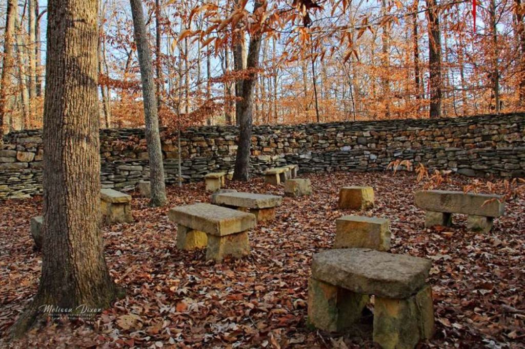
Wichahpi Commemorative Stone Wall, Milepost 337.9
In northwest Alabama, Tom Hendrix has been building a stone wall for over 30 years in memory of his great-great-grandmother’s journey.
His great-great-grandmother Te-lah-nay was part of the Yuchi Indian tribe that lived near here along the Tennessee River in the 1800s.
Her journey began when she and her sister Whana-le were sent to the Indian Territory of Oklahoma as part of the removal of native peoples from the southeast. But, that was only the beginning of her journey. Her tribe called the Tennessee River the Singing River because they believed a woman who lived in the river sang to them. When Te-lah-nay arrived in Oklahoma she said the streams and rivers did not sing to her and she longed for home. After spending one winter in Oklahoma she decides to head home. Even though she is alone the lessons that her grandmother taught her as a little girl help her overcome every peril and obstacle along the way. After enough adventure to literally fill a book she returns home and to the Singing River.
Fortunately, Tom’s grandmother (Teh-la-nay’s granddaughter) told him the stories about his great-great-grandmother when he was a little boy. Later in life Tom knew he needed to do something to honor her memory. During a conversation with an elder of the Yuchi tribe he was told “All things shall pass. Only the stones will remain.” It was then that he knew what he needed to do.
Rock Spring, Milepost 330.2
Rock Spring – a nature trail offers you an opportunity to explore a small natural spring as it bubbles forth from the ground. Small fish dart about in the deep pools created as the stream wanders through the rich bottomland soil and limestone rock. Vegetation and trees change as you move through an abandoned field past the stream into a rocky hillside. After completing the 20 minute walk you may decide to pull off your shoes and dangle your feet in the swift cool water.

Colbert Ferry Stand Site, Milepost 327.3
George Colbert used to live atop this ridge overlooking the Tennessee River. As one of the many inns that dotted the Trace between Nashville and Natchez, it provided travelers with food and lodging. At this site you can take a short walk up to the ridge where the home once sat. An additional 20-minute stroll will take you along the Old Trace to the bluff overlook of the river.
MISSISSIPPI


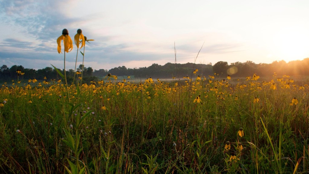
Tishomingo State Park, Milepost 304.5
Located in the foothills of the Appalachian Mountains in northeast Mississippi, Tishomingo State Park is Mississippi’s most scenic state park. The park is named for Chief Tishomingo. The Natchez Trace Parkway travels through the middle of the park and has an exit at milepost 304.5 to the park entrance.
Visitors to Tishomingo State Park can discover the same timeless natural beauty that enchanted Native Americans centuries ago. Tishomingo offers a unique landscape of massive rock formations and fern-filled crevices. Massive boulders blanketed in moss dot the hillsides, and colorful wildflowers border trails once walked by Native Americans.
Activities and recreational facilities include: picnic area with tables and grills, picnic pavilions, lodge facility, disc golf courses, compass course, hiking trails, playgrounds, multi-use field, volleyball court, and a swimming pool. Rock climbing is available by permit. Canoe trips and fishing are available on Bear Creek. Haynes Lake, a 45 acre fresh water lake, is available for fishing.
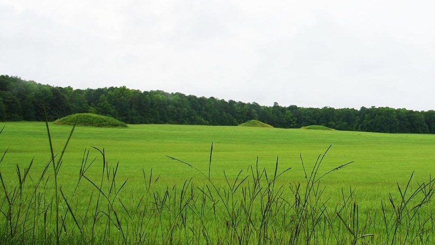
Pharr Mounds, Milepost 286.7
Around 2,000 to 1,800 years ago native people built Pharr Mounds, a complex of eight dome-shaped mounds, spread over 90 acres (100 football fields). One of the largest Middle Woodland era mound sites in the region, Pharr Mounds was near a sizable village.

Old Trace and Confederate Gravesites, Milepost 269.4
A paved trail leads to an original section of the old Natchez Trace. Beside the Old Trace, are the graves of thirteen unidentified Confederate soldiers.

Parkway Visitor Center, Milepost 266.0
The Natchez Trace Headquarters is located adjacent to the parkway in Tupelo. Information Center, bookstore, exhibits, short movie, restrooms, nature walk and offices.
The visitor center is open 9 a.m. to 4:30 p.m. daily. Closed Thanksgiving Day, Christmas Day, and New Years Day. Visitor center phone number is 662.680.4027.
Nearby, is the northern trailhead of the 6 mile-long Blackland Prairie Trail (a segment of the Natchez Trace National Scenic Trail). You can walk/hike south to the Old Town Overlook site or further south to the Chickasaw Village Site.
Chickasaw Village Site, Milepost 261.8
The Chickasaw Village Site is nearly 90 acres of Blackland Prairie and forest in the heart of Tupelo, MS. The size and shape of the Chickasaw summer and winter homes are preserved. The Natchez Trace National Scenic Trail goes through the village site. An interpretive shelter offers information about the Chickasaw people.

Bynum Mounds, Milepost 232.4
Bynum Mounds are the oldest mound site along Natchez Trace Parkway. These mounds were created by American Indians in what was known as the Middle Woodland Period between 100 BCE-100 CE. The mounds range in height from five feet to 14-feet. Originally, there were six mounds at this site. However, in the 1940’s five of them were excavated by National Park Service archeologists. The two largest mounds were rebuilt.

Jeff Busby Overlook, Milepost 193.1
Located at Milepost 193.1, the Jeff Busby Overlook stands on the summit of a large hill, and provides a scenic view of the Parkway and the forested areas around it. The overlook features an exhibit that provides information about the natural history of the area, as well as the human history in the area. Towards the northern edge of the parking lot a trailhead can be found for the Little Mountain Trail.
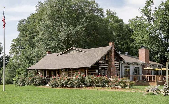
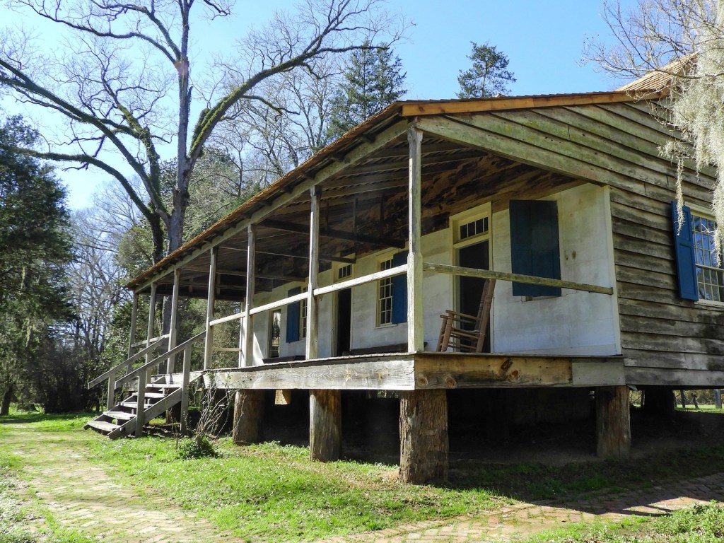
French Camp Historic Village, Milepost 180.7
French Camp Historic Village sits alongside the Natchez Trace. Come discover how early American life used to be in this quaint log cabin village. The Huffman Cabin Gift Shop and the French Camp Log House Museum are open to the public Monday – Saturday from 9:00 a.m. to 4:00 p.m.
The Council House Restaurant is open on Monday from 11 am to 2 pm, Tuesday thru Thursday from 11 am to 7 pm and Friday and Saturday from 11 am to 8 pm.
Other historic buildings include the Colonel James Drane House, The LeFlore Carriage House, Black Smith Shop, Welcome Center and Bread Bakery. And, French Camp has four bed and breakfast cabins.
The French Camp Historic Village and French Camp Bed and Breakfast are part of the adjacent French Camp Academy, a Christian boarding school-home dedicated to creating a warm and nourishing environment for its students.

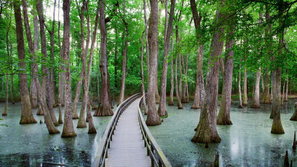
Cypress Swamp & River Bend, Milepost 122
In 1698, the French Explorer, Pierre LeMoyne Sieur d’Iberville, sailed into the mouth of this river and found pearls. He named it ‘River of Pearls’. The Natchez Trace, 100 years later, avoided the marshy lowlands by following the ridge between the Pearl River and the Big Black River for 150 miles. The last 75 miles of the river course have served since 1812 as a boundary between Mississippi and Louisiana.
Many years ago, the Pearl River flowed here. The river changed course. A shallow area was created by the deposition of sediments as the river retreated. During periodic low water, seedlings of water-tolerant cypress and tupelo trees gained a foothold. The trees you see today are a result. This is also a trailhead for the Yockanookany Section of the Natchez Trace National Scenic Trail.
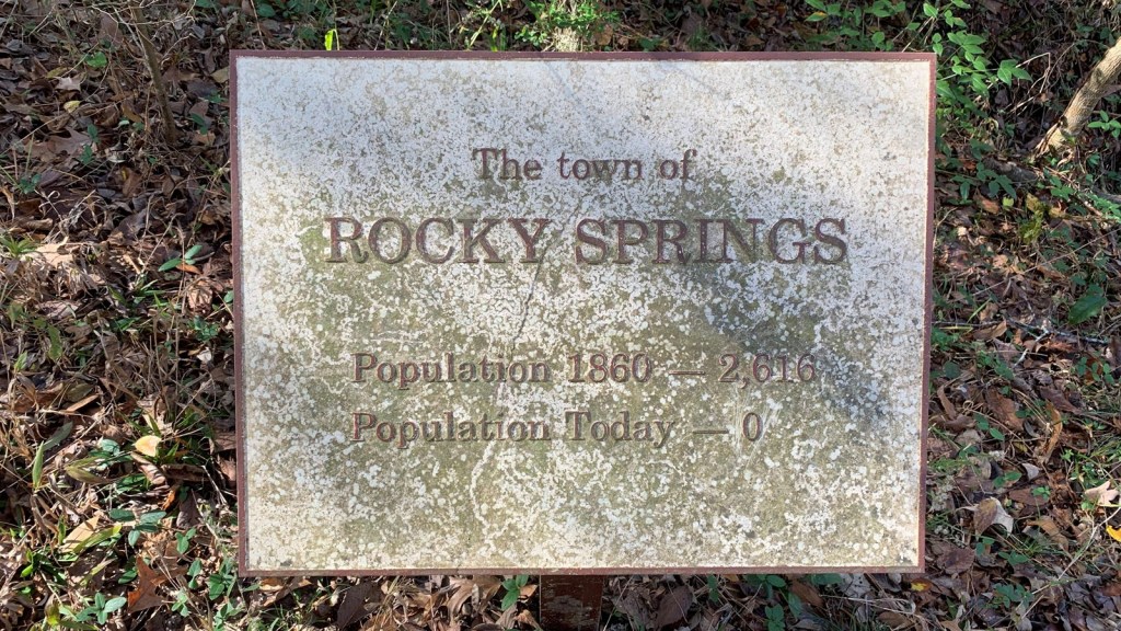
Rocky Springs Town Site, Milepost 54.8
The Town of Rocky Springs. At the end of this trail is evidence of a once thriving community. First settled in the late 1790s, the town grew from a watering place along the Natchez Trace, and took its name from the source of that water – the rocky springs. In 1860, a total of 2,616 people lived in this area covering about 25 square miles. The population of the town proper included three merchants, four physicians, four teachers, three clergy and 13 artisans; while the surrounding farming community included 54 planters, 28 overseers and over 2,000 slaves who nurtured the crop that made the town possible – cotton. Civil War, Yellow Fever, destructive crop insects and poor land management brought an end to this once prosperous rural community.
Today, the Rocky Springs site includes a 22-site campground, picnic tables and restrooms.
Hiking options include: a hike-able section of the Old Natchez Trace, self-guiding walking trails through the old town site and the spring and access to the 7 mile-long Rocky Springs Trail (a segment of the Natchez Trace National Scenic Trail) – you can hike south about three miles to the Owens Creek Waterfall site (the four mile section of the Rocky Springs trail from the campground north to its northern terminus at Fisher Ferry Road is currently closed).

Sunken Trace, Milepost 41.5
This is a portion of the deeply eroded or “sunken” Old Trace. The natural corridor that became the Natchez Trace dates back many centuries. As the United States expanded westward in the late 1700’s and early 1800’s, growing numbers of travelers tramped the rough trail into a clearly marked path. Where the ground was relatively soft with loess soil, thousands of walkers, riders, and wagons wore down these paths into “sunken” sections, such as this one you see before you.

Windsor Ruins, Milepost 30.0
Built in 1859-61 by Smith Daniell who only lived in the large mansion for a few weeks before he died. The Windsor plantation once sprawled over 2,600 acres. Legend says that from a roof observatory, Mark Twain watched the Mississippi River in the distance. A Union soldier was shot in the front doorway of the home. During the Civil War the mansion was used as a Union hospital and observation post, thus sparing it from being burned by Union troops. However, after the Civil War, during a house party on February 17, 1890 a guest left a lighted cigar on the upper balcony and Windsor burned to the ground. Everything was destroyed except 23 of the columns, balustrades and iron stairs.
Windsor Ruins is open to the public during daylight hours every day. There is no fee. Wonder why the columns have stood for 130 years? Click here to find out!
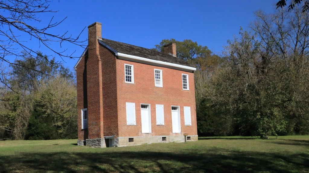
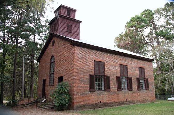
Mount Locust Historic House, Milepost 15.5
Mount Locust is a location that has been settled on by many different people and under many different flags during its long history of human occupation that dates back as far back as 600 C.E., long before Europeans first step foot in the area Centuries later in the 1780’s the historic house, one of the oldest structures still standing in an area, was built by the Fergusons who made it into a growing farm and occupied the site for five generations.

Emerald Mound, Milepost 10.3
Located about 10 miles northeast of Natchez, Mississippi, Emerald Mound is the second-largest Mississippian Period ceremonial mound in the United States, surpassed only by Monk’s Mound near Cahokia, Illinois. Built and used between the years 1200 C.E. (current era) and 1600 C.E., this 35-foot-high mound covers eight acres and measures 770 feet by 435 feet at its base.
Post Your Comment
Subscribe to BBMR
Thank you for following BBMR. If you are enjoying what you see here, please subscribe! Blast Often!

You must be logged in to post a comment.